As Lagos residents struggle with some of the world’s worst traffic congestion, an overlooked alternative is finally coming into clearer focus: water transport.
While a small percentage of the population already relies on ferries, many commuters remain uncertain about how the system works or whether it’s even a viable option.
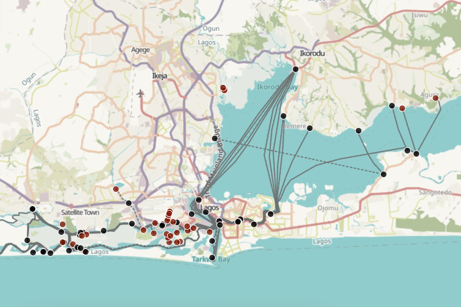
This uncertainty may reduce with the launch of a new interactive ferry map, the first public tool to comprehensively show both public and private ferry routes across Lagos.
Published in February 2025 by Stears Open Data, the map offers clarity to a fragmented system, especially for commuters in the Lagos Metropolitan Area.
The map outlines available ferry options in nine LGAs, their estimated fares, boat types, departure times, and Google Maps directions to terminals. It also includes photos and other details that demystify water transportation in Lagos.
“The private ferry network is quite opaque, and people only learn about the routes via word-of-mouth,” Head of Stears Open Data, Hannah Kates, told Ikeja Record. “Commuters also don’t know about the potential time savings from taking the ferry.”
Kates added that the map’s goal is to fill a critical information gap and spark a conversation about multi-modal public transportation in Lagos.
“By educating Lagos commuters about the availability and advantages of ferry transportation, we aim to enable faster, more enjoyable commutes and help reduce traffic congestion,” Kates said.
Making informal routes visible
One of the map’s most valuable contributions is its documentation of informal ferry routes run by private boat operators without fixed schedules.
These services are often the only options available in underserved or waterfront communities,but “people only learn about them through word-of-mouth”.
To document the informal routes, the Stears Open Data team hired field researchers who visited dozens of locations, rode the ferries, interviewed operators and recorded real-time GPS data.
However, recognising that informal services are subject to change, the map includes a feedback feature that allows commuters to submit corrections and new data to keep the information current and reliable.
“We want users to help us keep the data fresh by reporting changes or edits to ferry locations and routes based on their experience from riding the ferries,” Kates told Ikeja Record.
The data is also available through Stears Open Data’s publishing partners, including OrnaMap, a navigation app that provides step-by-step directions with last-mile bus connections, and OpenStreetMap, which allows for broader public use.
“We are very open to other partnerships or ideas that will help us reach more people,” Kates said.
